
The Best Platforms to Visualize Construction Site Progress from Drone Footage
- Garen Petrossian
- Aug 4, 2025
- 4 min read

In today’s fast-paced construction industry, staying on schedule and managing multiple teams effectively is crucial. Drone technology is rapidly becoming a go-to solution, providing accurate and detailed aerial imagery that allows project managers to track progress in real-time. But collecting drone footage is only half the battle—using the right visualization platform is essential to extract maximum value from your data.
With so many tools on the market, choosing the best platform to visualize construction site progress can be challenging. Ideal platforms should enable easy uploads, intuitive navigation, precise measurement tools, and seamless sharing capabilities. Whether you’re a developer, contractor, or construction manager, leveraging these platforms can significantly enhance your decision-making processes, streamline communication, and improve overall efficiency.
This blog highlights the top visualization platforms for drone footage in construction, comparing key features and benefits to help you select the ideal tool for your needs.
1. DroneDeploy—Powerful, Intuitive Visualization

DroneDeploy is a market-leading drone mapping and visualization platform widely trusted by construction professionals worldwide. It provides a comprehensive, user-friendly interface that simplifies uploading drone footage and quickly converts it into detailed 2D maps, 3D models, and accurate orthomosaics.
Key advantages of DroneDeploy include high-resolution aerial imagery, seamless cloud-based storage, and integration with leading construction management tools like Procore and Autodesk. DroneDeploy also provides real-time annotations and measurements, which enable project managers and stakeholders to review site conditions and progress remotely.
Additionally, DroneDeploy’s mobile app offers field teams immediate access to visualizations directly from their smartphones or tablets, enhancing onsite collaboration. Powerful reporting capabilities allow managers to generate visual progress reports easily, improving transparency and client communication. Its intuitive layout, reliability, and scalability make DroneDeploy an ideal choice for construction companies of all sizes aiming for clarity and efficiency in project oversight.
2. Pix4Dcloud – Accurate 3D Modeling and Analysis

Pix4Dcloud is known for its advanced photogrammetry capabilities, making it an excellent choice for construction teams needing precise 3D modeling. The platform automatically processes drone imagery into accurate 3D models, orthomosaics, and digital surface models (DSM), giving teams unmatched insights into site conditions.
A standout feature of Pix4Dcloud is its powerful analytics engine. This engine enables users to conduct volume calculations, compare models over time, and analyze elevation changes to monitor progress accurately. Users can easily overlay CAD designs onto drone imagery, allowing quick visual comparisons between planned and actual conditions.
Another critical advantage of Pix4Dcloud is its cloud-based collaborative workspace. Teams can securely access and annotate models from anywhere, facilitating real-time project monitoring and rapid issue resolution. For construction managers seeking a highly accurate, analytics-driven visualization tool, Pix4Dcloud delivers exceptional precision and data-driven insights.
3. Propeller Aero – Built for Construction Professionals

Propeller Aero is specifically designed with construction and earthworks projects in mind, offering specialized tools for tracking and visualizing site progress. The platform seamlessly integrates drone data with ground control points, ensuring centimeter-level accuracy ideal for precise measurement of stockpiles, earthworks, and grading.
Propeller’s visualization tools excel at tracking site changes over time, enabling construction teams to measure volumes, track cut-and-fill operations, and manage resources more efficiently. The platform also provides easy-to-use progress reporting features, ensuring stakeholders remain informed and aligned throughout the project lifecycle.
Moreover, Propeller’s integration with Trimble and Komatsu smart equipment enhances data accuracy and workflow automation, providing construction teams with end-to-end site monitoring capabilities. With its user-centric approach and practical construction features, Propeller Aero is a top choice for managing complex site workflows effectively.
4. Skycatch—Real-Time Insights and Collaboration

Skycatch offers robust solutions for construction professionals looking for real-time drone data visualization and analytics. Known for its speed, Skycatch converts drone footage quickly into actionable visual data, providing immediate access to detailed aerial maps, 3D models, and contour analyses.
One of Skycatch’s standout features is its intuitive dashboard, which allows users to monitor multiple job sites simultaneously. With built-in measurement and annotation tools, project teams can rapidly assess site progress, perform accurate volume measurements, and share data securely with stakeholders in real-time.
Skycatch integrates seamlessly with popular construction management software platforms, enhancing communication between site teams, clients, and contractors. For projects that require instant feedback and data-driven decision-making, Skycatch offers a streamlined and highly collaborative approach that simplifies drone-based construction visualization.
5. Autodesk Construction Cloud – Integrated Project Visualization
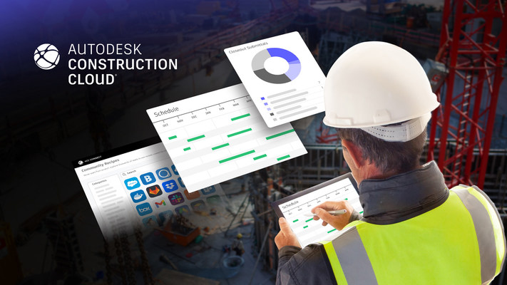
Autodesk Construction Cloud stands out due to its deep integration with existing Autodesk products like BIM 360 and Revit. This integration allows construction teams to visualize drone-captured imagery and 3D models alongside traditional project files, creating a unified project overview.
With Autodesk Construction Cloud, project stakeholders can compare drone-captured visuals with project plans and CAD models effortlessly. The ability to overlay drone-generated orthomosaics onto original design files facilitates accurate construction verification, improving quality control and ensuring alignment with initial project specifications.
Additionally, Autodesk’s robust collaboration features support centralized communication, annotations, and approvals. This integrated approach allows project teams to quickly identify discrepancies, streamline workflows, and reduce costly delays. For construction companies already using Autodesk software, Autodesk Construction Cloud is the ideal platform for maximizing drone footage value and enhancing project coordination.
Conclusion
Selecting the right visualization platform for your drone-captured construction site progress data is critical to maximizing efficiency, accuracy, and communication throughout your project. Whether your priorities are ease-of-use, precise analytics, or seamless integration with existing software, each of the platforms mentioned—DroneDeploy, Pix4Dcloud, Propeller Aero, Skycatch, and Autodesk Construction Cloud—offers unique strengths tailored to specific project needs.
By leveraging these advanced visualization platforms, construction professionals can gain unparalleled insights into project progression, minimize risks, and significantly enhance stakeholder collaboration. Ultimately, adopting the right drone visualization tool will not only streamline your workflow but also lead to smarter, more informed decisions that keep projects on track and within budget.
Ready to enhance your construction site monitoring with professional drone footage and powerful visualization tools? Petrossian Aerial provides expert drone services across Southern California, delivering precise aerial data tailored to your construction needs. Our licensed drone pilots and state-of-the-art technology offer accurate, actionable insights that keep your projects running smoothly.


Comments